
McDougall United Memorial Church
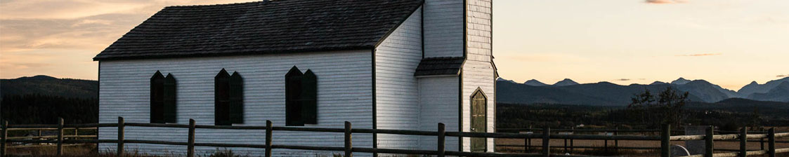
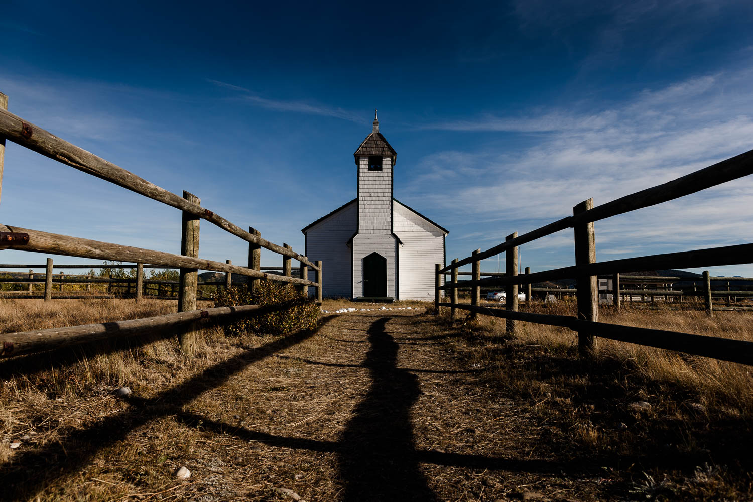
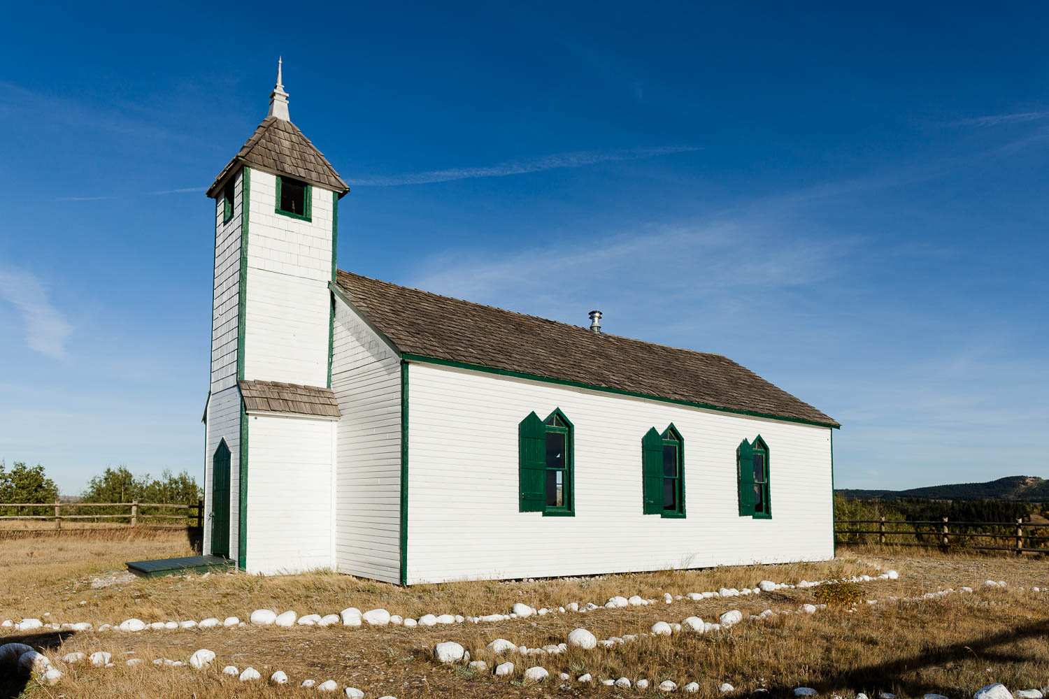
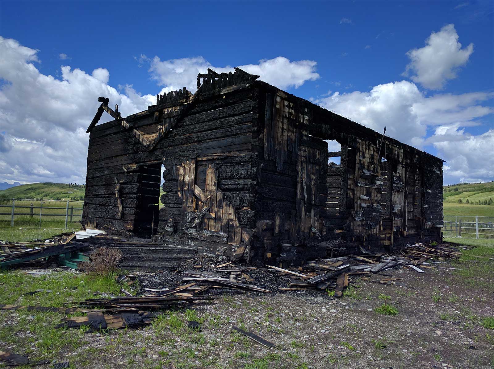
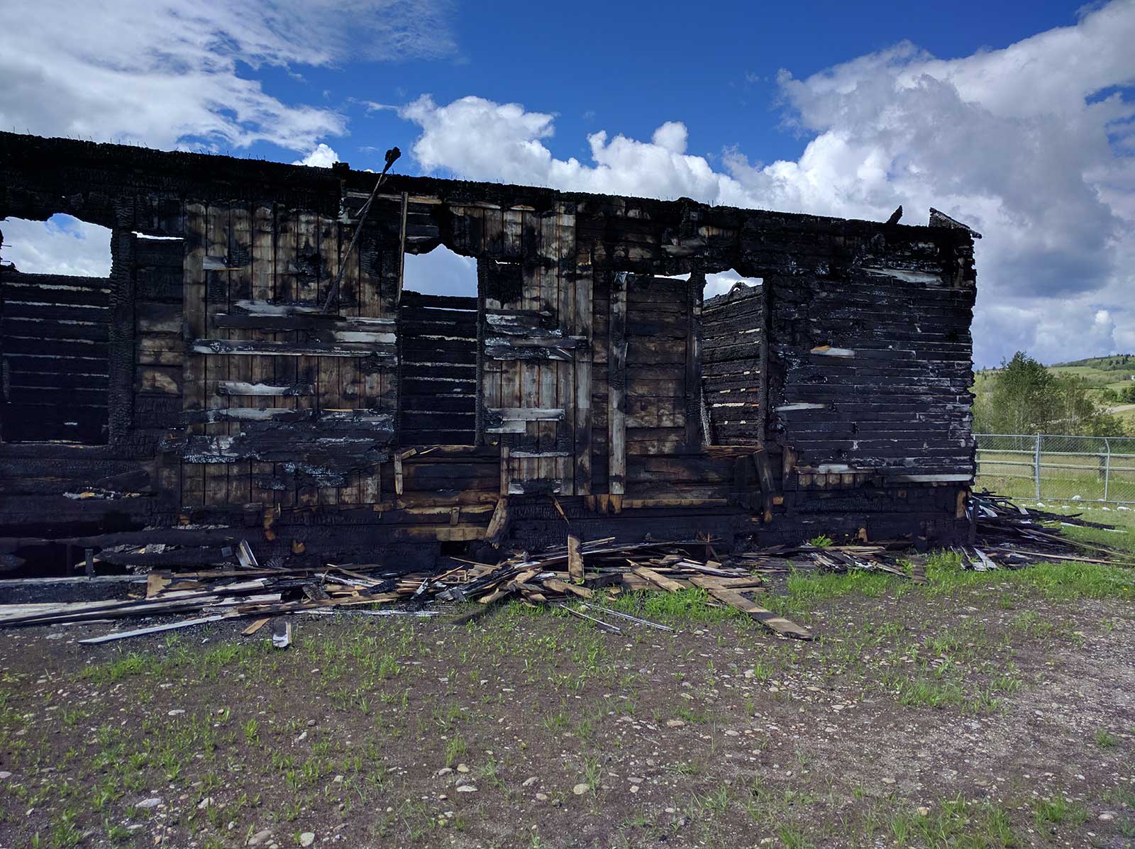
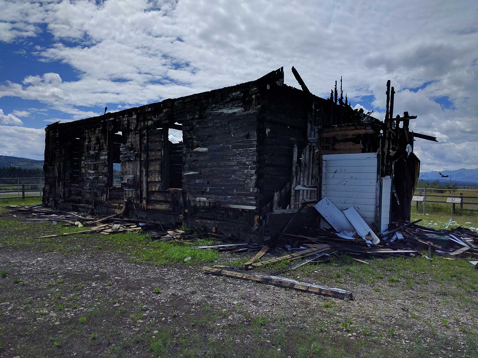
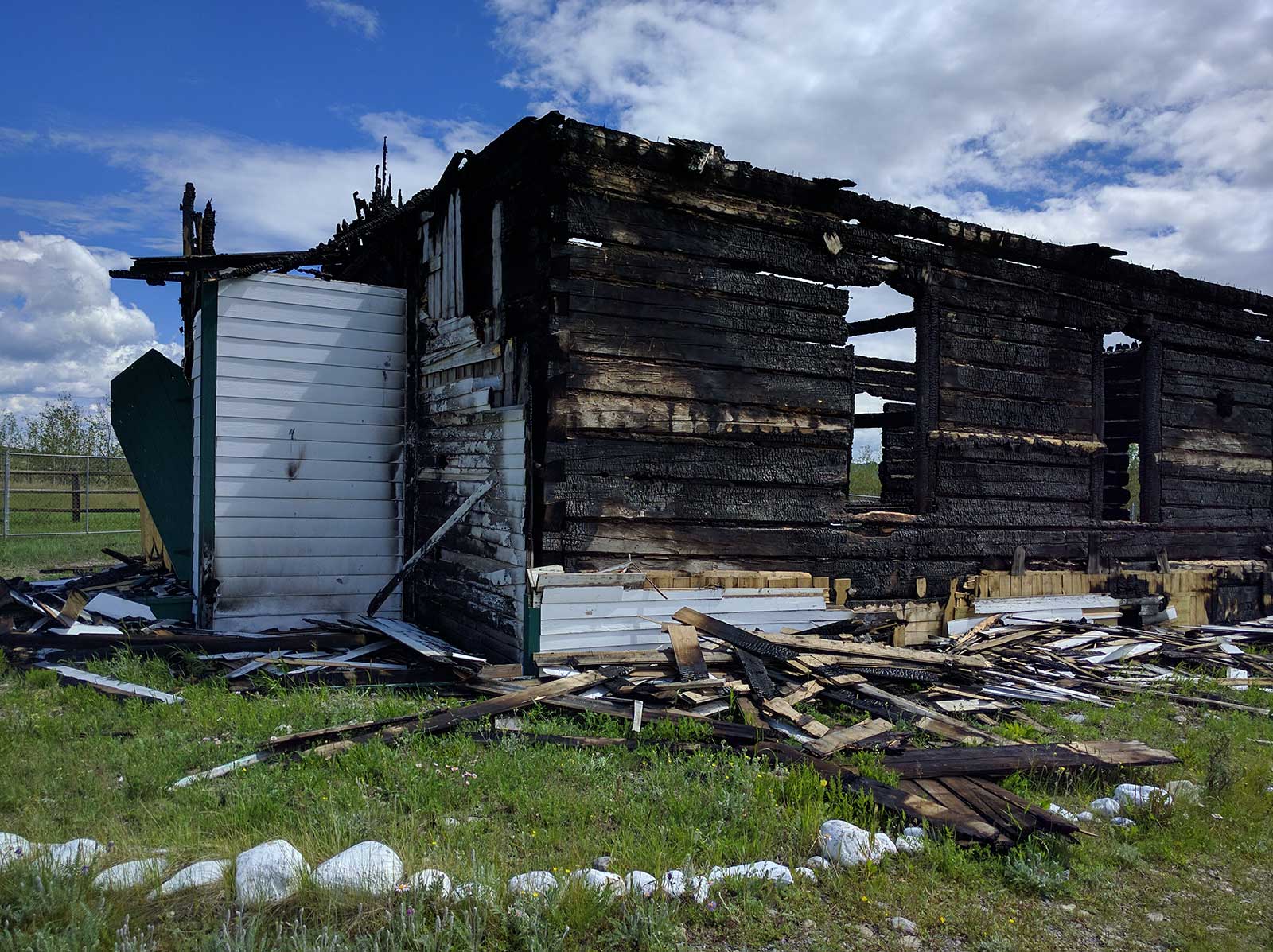
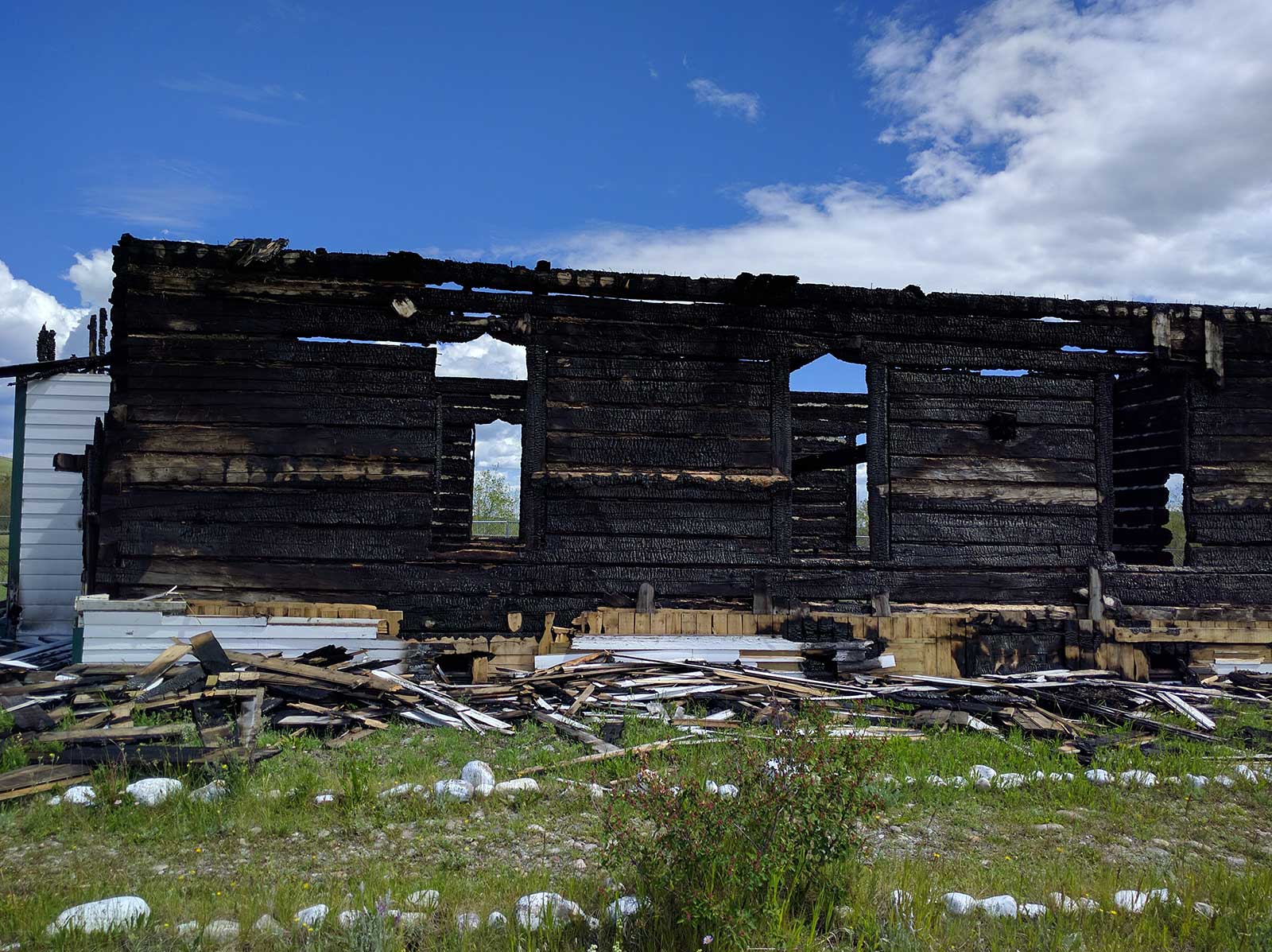
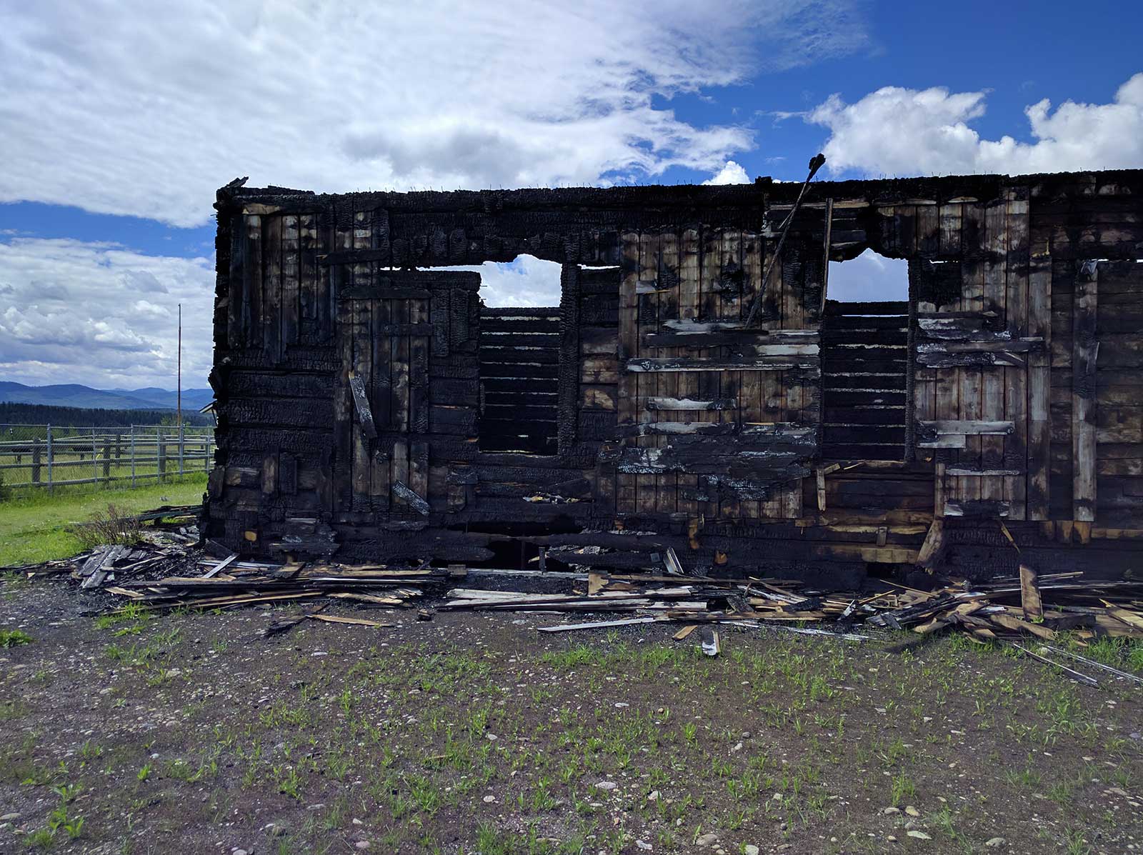
The McDougall Memorial United Church is a one-storey building located on the north bank of the Bow River, roughly two kilometres east of Morley. The church was constructed in 1875 in the Carpenter’s Gothic style and features pointed arch windows and front door, shingled front-gabled roof, and a central steeple crowned by a pinnacle. The designation also includes the archaeological remains of mission structures at the site. This is a subsampled point cloud of the McDougall Church post-fire.
Region:
Southwest Alberta
Field Documentation:
June 1, 2017
Field Documentation Type:
Terrestrial LiDAR
Culture:
Scottish, Stoney
Historic Period:
1875CE
Latitude:
51.151655
Longitude:
-115.029925
Datum Type:
NAD 83
Threat Level
The Church
The McDougall Memorial United Church at Morley, Alberta was built by the Reverend George McDougall in 1875. McDougall, a Methodist minister, came west from Ontario at the request of the Hudson’s Bay Company to do missionary work. He spent several years near Fort Edmonton before coming further south to open a mission amongst the Stoney and Blackfoot people. The church was the centre point of the Morley Mission settlement founded by George, his wife Elizabeth and their eldest son John.
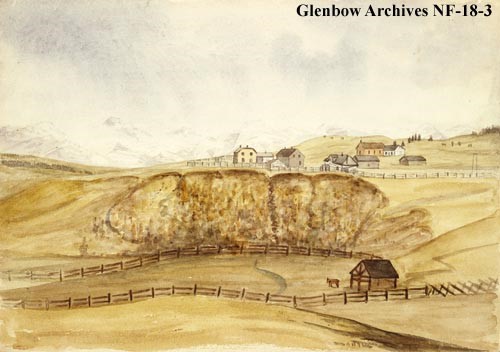
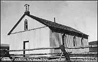
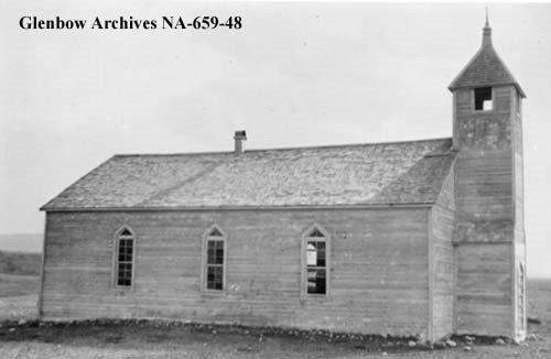
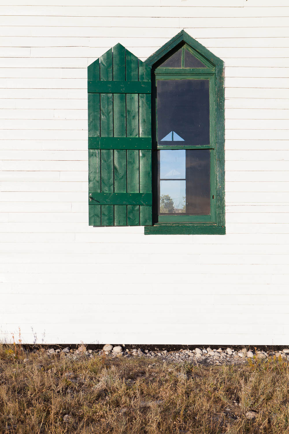
Morleyville, as the area surrounding the mission was called, was the first settlement in what is now Southern Alberta. The McDougall Church was the second oldest building in its original location in Alberta. It was built in a symmetrical rectangular shape out of local pine logs, squared to fit tightly and left unfinished for several years. The front roofline was gabled, and there were four stained glass windows and a bell hanging from a cross-beam between two posts outside the front door of the church. The church was unusual because it was the oldest example of a Carpenter’s Gothic style building in the Bow River Valley region. This style gained popularity in North America in the mid-nineteenth century, and was modeled after medieval European Gothic stone work most often seen on churches.
The church building underwent changes and additions over time, including vertical board and batten siding that was added to the walls in 1878. In 1900, a steeple was added. In keeping with the Carpenter’s Gothic style of the church it had a narrow body, a pyramid-like roofline and a galvanized metal spire.
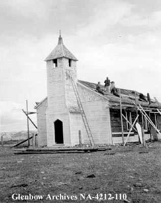
The McDougall Church was in regular use until the mission was abandoned in 1921. It sat empty for 30 years and fell into disrepair. In 1951, a volunteer group called the Morley Church Restoration Association was formed for the purpose of repairing the building. Restoration began in 1952, at which time the roof was replaced, the windows were repaired and the exterior was painted. After the restoration work the church was used as mainly as an interpretive centre, but was also used for weddings and religious services.
The Morley Church Restoration Association morphed into the McDougall Stoney Mission Society in 1971, and that group has managed the site since that time. In 1977, the site received Historic Site designation by the United Church of Canada. On December 20, 1979, the McDougall Church was declared a Provincial Historic Resource by the Province of Alberta, and on February 13, 2008, it was added to the Canadian Register of Historic Places.
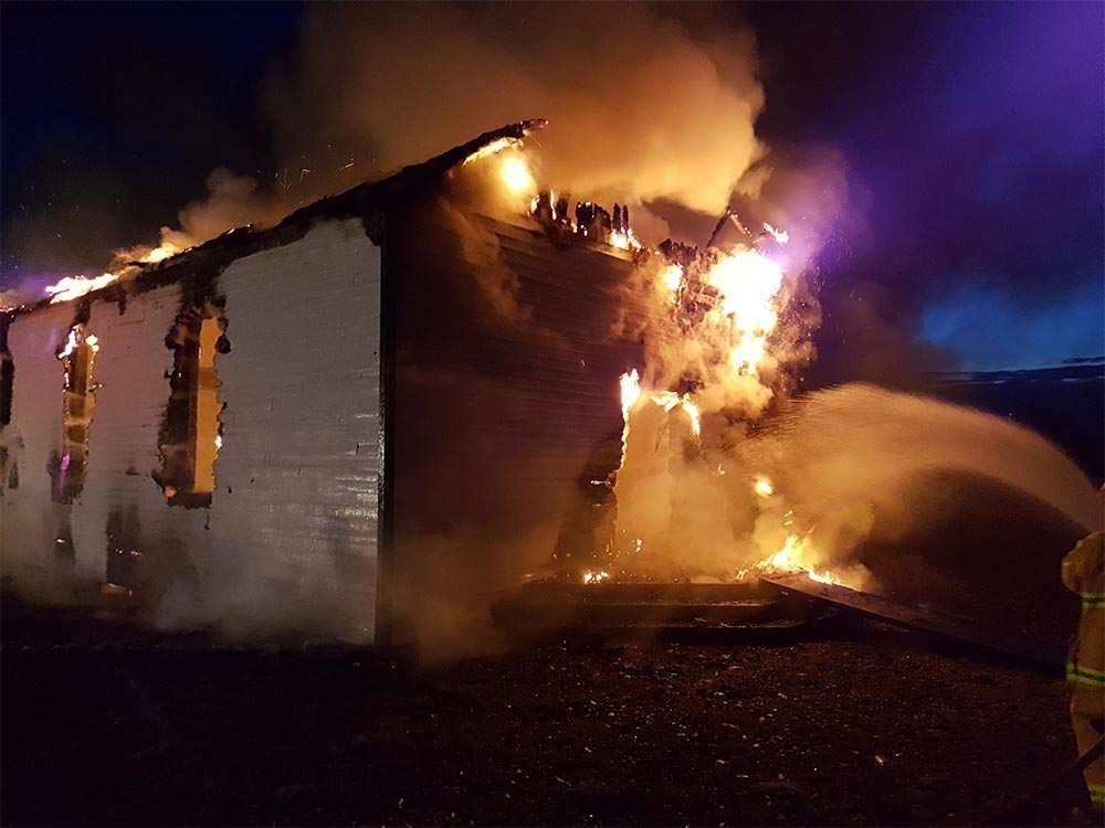
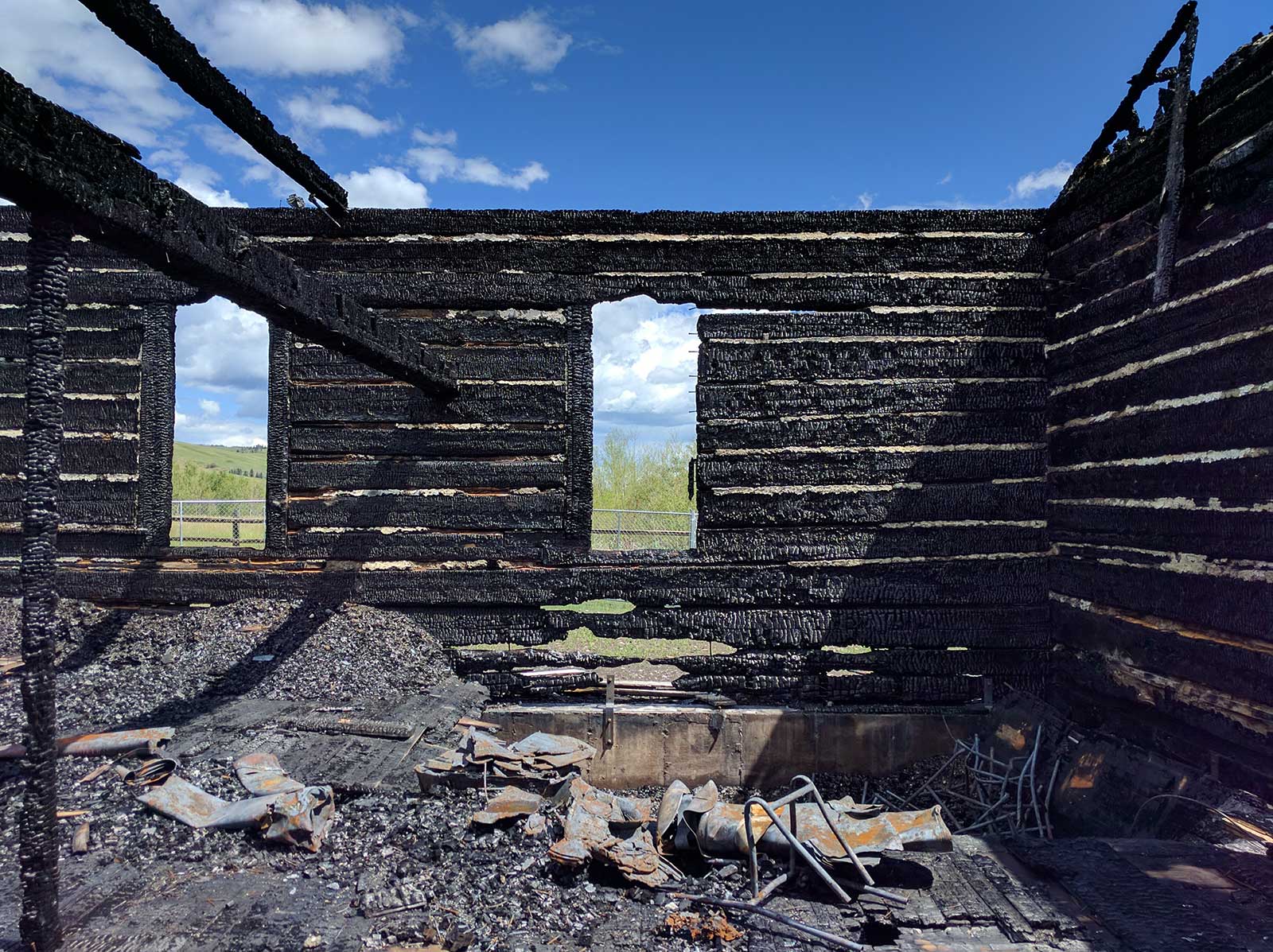
Shortly before 4:00 a.m. on Monday May 22, 2017, fire broke out in the church. By the time firefighters arrived, the church was fully engulfed and the roof had collapsed. Although the structure was not burned completely to the ground, it is currently unknown whether or not reconstruction will be possible.
Reverend George McDougall
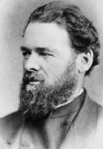
George Millward McDougall was born in 1821 in Ontario. He was ordained as a Methodist minister in 1854 and, after spending time with indigenous groups in Northern Ontario, committed his life to working amongst Canada’s aboriginal people [1]. He spent two years at the Rossville Mission in Manitoba, after which he was appointed Superintendent of Northwestern Methodist Missions. With his wife and children, he moved in 1863 to an area 130 kilometres east of what is now Edmonton, Alberta, where they founded the earliest Methodist mission on the prairies, known as the Victoria Mission. After a smallpox epidemic devastated the population, including members of their family, the McDougalls relocated to Fort Edmonton. In 1872, Reverend McDougall built the first church in the area just outside the Fort [2].
In 1873 the McDougalls relocated once again, this time to the south near the Bow River. George had visited the area as early as 1864 and had hoped to be able to come and work amongst the Stoney people, but felt it was important to establish missions in the north before moving south. After originally settling his family north of the Bow River, in 1874, he moved his family to a site approximately five kilometres south-east near a natural ford in the river along a route that was traditionally used by the Stoney people [2] This became the location of his Morley Mission.
Construction on the church began in 1874 and was completed in 1875. Soon to follow were an orphanage, a school, and a trading post. George McDougall’s church was the core of a settlement called Morleyville which grew up around it [3]. Sadly, George did not live long enough to see the community grow into the largest settlement in the Bow River Valley. In January 1876, he went on a bison hunting trip with his sons to procure meat to feed the residents of the mission. A blizzard sprang up, and when the rest of the hunting party arrived back at the mission they discovered that George had not returned. His body was found ten days later near Nose Creek and returned to the mission for burial [1].
Elizabeth Chantler McDougall
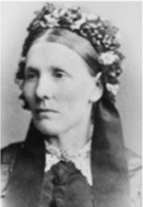
Elizabeth Chantler McDougall was born in 1818 to a Quaker family in England [1]. She came to Canada as a young woman and met George McDougall, the man who would become her husband of 34 years, at a Wesleyan Methodist Revival Meeting in Upper Canada. Elizabeth and George married in 1842 [3].
After their marriage, Elizabeth supported George in his mission work with the Methodist church, spending time in northern Canada working with indigenous people. She followed him as he moved to Manitoba and then to what is now Alberta to establish missions and minister to the aboriginal people of those areas [3].
Elizabeth and George had nine children of their own, plus one adopted daughter. Their biological children were John, David, Moses, Eliza, Elizabeth, Nellie, Georgiana, Flora, and George. David died in childhood, and their adopted daughter, Anna Masterchild, as well as Georgiana, Flora and Anna, all died of smallpox during the epidemic at the Victoria Mission in the 1870s [2].
Elizabeth was indispensable in helping her husband George and their son John to establish the mission at Morley. When they were away, she would manage the operation of the mission on her own. She was known as a role model and source of encouragement to early pioneer women in the area. She was also seen as a mother-like figure who tended to the sick and helped those in need [3]. After the death of her husband George in 1876, she lived with their youngest son, George Jr, until he died from pneumonia in 1880 [3].
Despite enduring many tragedies, she stayed at the mission in Morleyville until her death in 1903. At her funeral, six Stoney Chiefs carried her casket into the mission church which was filled to overflowing with mourners who had come to pay their respects to this courageous woman [3].
Notes:
This site is located on Treaty 7 Territory of Southern Alberta, which is the traditional and ancestral territory of the Blackfoot Confederacy: Kainai, Piikani and Siksika as well as the Tsuu T’ina Nation and Stoney Nakoda First Nation. This territory is home to the Métis Nation of Alberta, Region 3 within the historical Northwest Métis Homeland. We acknowledge the many First Nations, Métis and Inuit who have lived in and cared for these lands for generations. We are grateful for the traditional Knowledge Keepers and Elders who are still with us today and those who have gone before us. We make this acknowledgement as an act of reconciliation and gratitude to those whose territory we reside on or are visiting.
[1] Glenbow Archives, Series 1: George McDougall. – 1852-1876. George and John McDougall Family Fonds. DOI: http://www.glenbow.org/collections/search/findingAids/archhtm/mcdougall.cfm#series6, accessed 15 November, 2017.
[2] Nix, James Ernest, 2003. McDougall, George Millward. Dictionary of Canadian Biography, 14. University of Toronto/Université Laval. DOI: http://www.biographi.ca/en/bio/mcdougall_george_millward_10E.html, accessed 6 March, 2018.
[3] McDougall Stoney Mission Society Website, 2017 http://www.mcdougallstoneymission.com/about.php. Accessed 12 November, 2017.
Notes – Elizabeth Chantler McDougall
[1] Nix, James Ernest, 2003. McDougall, George Millward. Dictionary of Canadian Biography, 14. University of Toronto/Université Laval. DOI: http://www.biographi.ca/en/bio/mcdougall_george_millward_10E.html, accessed 6 March, 2018.
[2] Glenbow Archives, Series 1: George McDougall. – 1852-1876. George and John McDougall Family Fonds. DOI: http://www.glenbow.org/collections/search/findingAids/archhtm/mcdougall.cfm#series6, accessed 15 November, 2017.
[3] McDougall Stoney Mission Society Website, 2017 http://www.mcdougallstoneymission.com/docs/The_Morleyvillle_Story.pdf,
accessed 12 November, 2017.
All historical images were sourced from the Glenbow Archives with modern images provided by Raina and Wilson and Al Hogarth.
Digitally Capturing the McDougall Church
Two approaches were used to digitally capture the McDougall United Memorial Church. A Z+F 5010X laser scanner was used to capture the exterior of the building, while a Phantom 4 drone with Pix4D was used to image what remained of the interior.
Scanning the church after the fire presented many challenges. First, the darkening of the exterior caused by the fire damage made acquiring color data for the point cloud difficult. Second, a large amount of debris was distributed in areas around what remained of the church, which restricted where we could place the scanner.
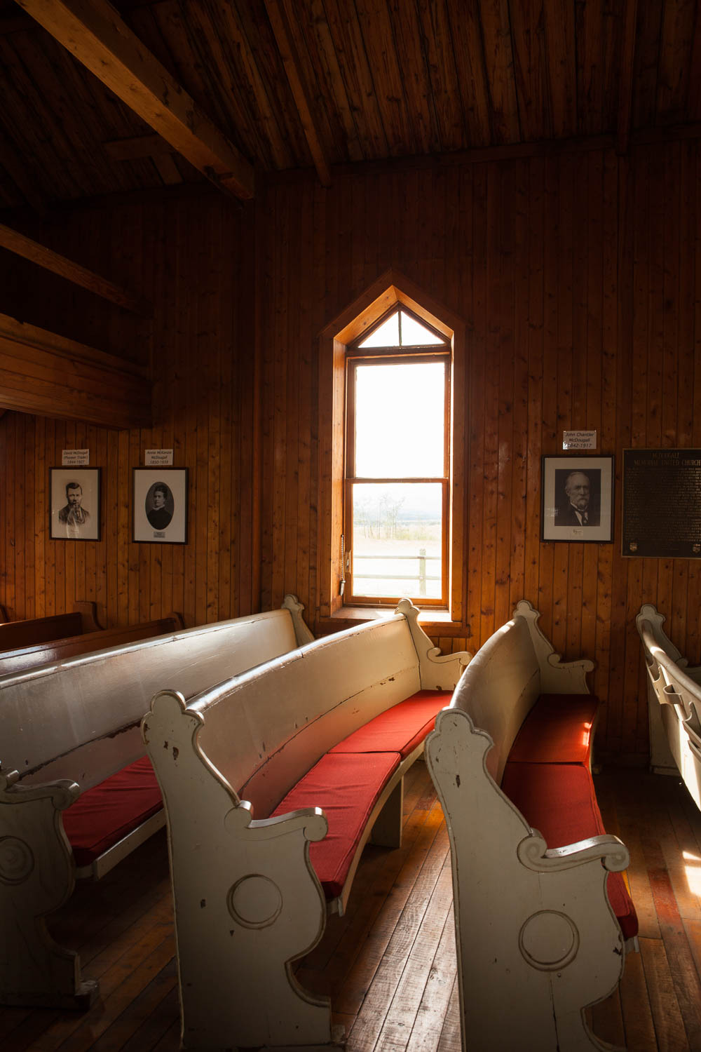
Extensive damage to the interior and floor made scanning inside the church impossible. This problem was solved by using the drone to fly over the church in a grid pattern to capture the interior and any details, such as the altar and piano, that remained.
Six paddle targets were strategically placed around the exterior of the church, such that no less than three were visible from each scanning location. The building was then captured in its entirety from 8 scanning locations around the outside. The scans were registered using Z+F Laser Control software, and then exported into AutoDesk ReCap for further processing. The resulting point cloud was imported into AutoDesk ReMake to create a 3D model of the building.
The DJI drone was flown in an overlapping grid over the church at an altitude of 20 meters, such that the images captured by the onboard camera overlapped by 90%. The resulting images were processed using Pix4D mapper software, creating a point cloud, 3D model, DSM, and orthomosaic of the site.
Accurate data has been taken directly off the point cloud of the church, including heights and lengths of what remains of the standing walls, and distances from the building to a nearby stone memorial.
Specific architectural details which are visible in the point clouds will provide important information should the church ever be reconstructed.
Scan Locations


Open Access Scanning Data
The raw data files for this project are available for download from the archive repository. Scans are .las file format. Please download the metadata template to access metadata associated with each file. All data is published under the Attribution-Non-Commercial Creatives Common License CC BY-NC 4.0 and we would ask that you acknowledge this repository in any research that results from the use of these data sets. The data can be viewed and manipulated in CloudCompare an opensource software.
