
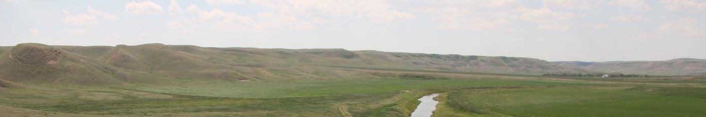
EaPd-7 and EaPd-8 Stone Circle Sites
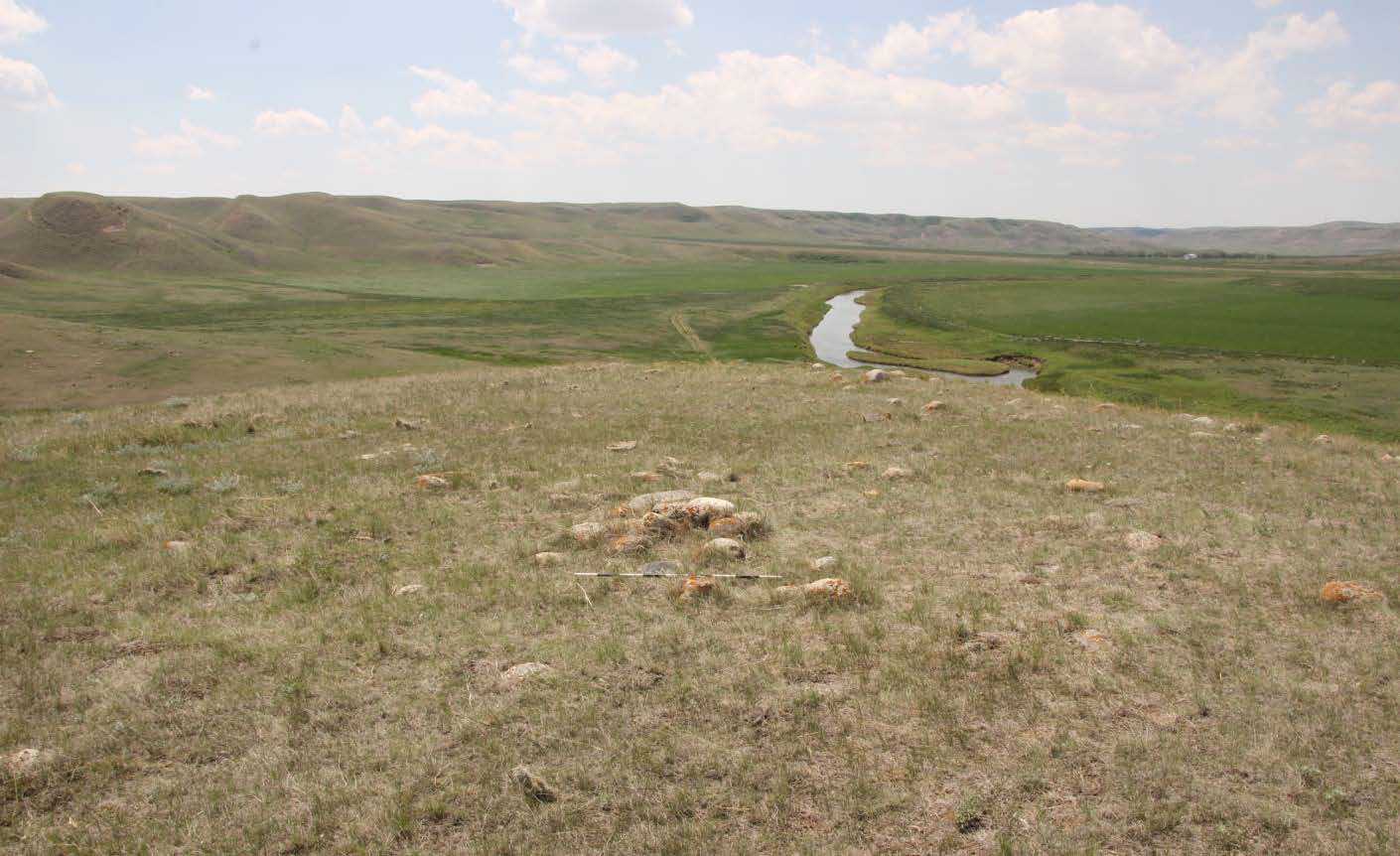
There is evidence of over 10,000 years of human occupation on the Alberta Plains [1]. While this is a vast expanse of time the nomadic lifestyles of the people of the plains left a minimal trace of their lifeways on the landscape. The physical remains can consist of a single stone tool to a complex of stone circles, effigies and medicine wheels. This site, located in southern Alberta, is evidence of a temporary camp with over 60 stone circles, cairns, alignments and a possible turtle effigy. A few of the stone circles have been tagged in the model, how many can you see?
Region:
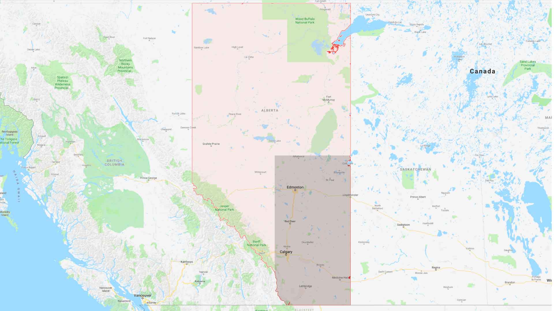
Southeast Alberta
Field Documentation:
May 26, 2018
Field Documentation Type:
Photogrammetry
Culture:
Blackfoot, Kootenai, Metis, Sioux, Tsuu T’ina
Historic Period:
CE
Latitude:
Longitude:
Datum Type:
WGS84
Threat Level
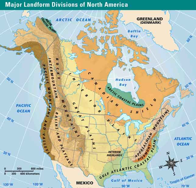
The Great Plains of North America
The Great Plains stretch from the Rio Grande in the south to the delta of the Mackenzie River at the Arctic Ocean in the north and cover an area of 2,900,000 square km [2]. The Great Plains is a semiarid grassland that ranges from extremely flat featureless sections to tree-covered mountains, but the most commonplace terrain are low hills and incised stream valleys [2]. The climate of the Great Plains is typified by cold winters and warm summers [2]. The vast expanse of grassland saw immense herds of bison and pronghorn before European settlement, who transformed the plains into agricultural landscapes with crops and ranching [2]. The plains have been divided into four main regions Northern, Intermediate, Central, and Southern Great Plains [3]. Alberta is situated largely within the Northern Great Plains, from the Rockies in the west to the Canadian Shield in the northeast.
The People of Southern Alberta
The Great Plains are home to a great number of Indigenous people, the plains of southern Alberta are the traditional territories of the Blackfoot (Nations of Kainai-Blood Tribe, Siksika, Peigan-Piikani and Aamskapi Pikuni.), Tsuu T’ina (Sarcee), Ktunaxa (Kootenay), Očeti Šakówiŋ (Sioux), and the Michif Piyii (Metis) [4]. Each of these groups has a distinct culture, however, the dependency on bison led to similar lifeways in following the seasonal round in hunting the bison and the temporary nature of their camps [1, 5].
Temporary Campsites
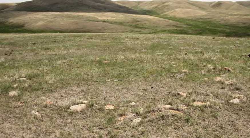
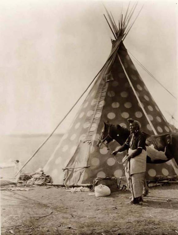
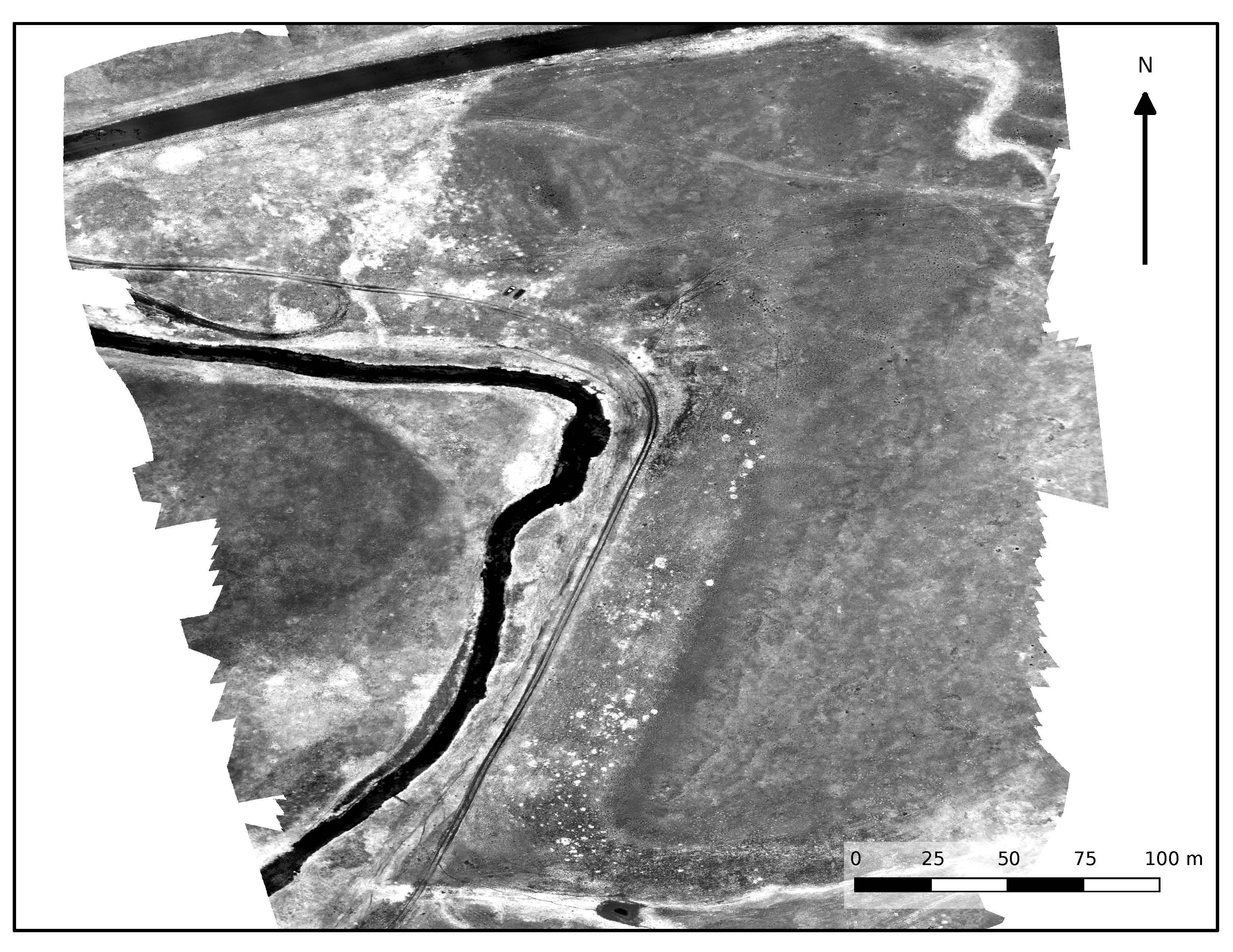
Temporary campsites are a common occurrence on the Albertan plains [6]. They are identified by numerous stone circles [6]. The circles of stone are usually the only visible remnants of the camps left behind, but the structures would have contained wooden uprights covered in buffalo hides with the stones pinning the skins to the ground [7]. These structures, known as tipis, varied in construction techniques between the different Indigenous groups from the number of uprights to the shape that the hides were placed in to cover the framework [7]. A gap within the stones represent an entrance and are usually found facing east [8]. Some stone circles are found with hearths in the center and have been interpreted as winter camps [8]. Circles without hearths are seen as summer camps [8].
These stone circle features start to appear in the archaeological record around 5,000 years ago and were replaced when the introduction of axes from European contact led to wooden pegs being used instead [8, 9]. Stone circles are often difficult to date or determine the specific function as there is little evidence found inside when excavating these features [6]. The number of stone circles present at a site varies greatly with some having only a couple of stone circles to others that have over 80 stone circles. Where there are sites with large numbers of stone circles, it is often hard to determine if the sites are multiple occupations or a single event due to the lack of material evidence found inside. Where multiple stone circles are found some patterns of organization can be seen with a single or double row, semi-circle, circle, triangle, V-shape or a haphazard shape [8].
Sites EaPd-7 & EaPd-8
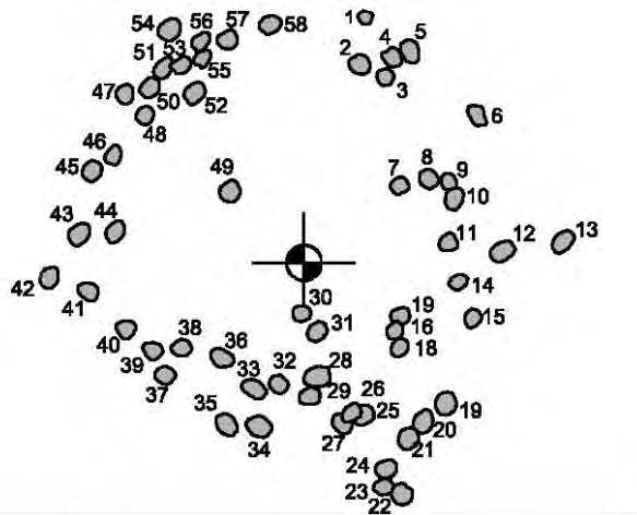
These two sites were rediscovered by archaeologists in 1992 during a survey of the area prior to the rerouting of a highway. The sites were located on terraces above a stream in typical prairie grasses of southern Alberta. Site EaPd-7 had six stone circles with no associated artefacts from 18 test holes dug in and around the circles. Site EaPda-8 had approximately 47 stone circles grouped roughly into 3 lines running along the terrace. In 2018 the Archaeological Society of Alberta (ASA) revisited the site to record the stone circles in more detail in creating hand-drawn plans of each of the circles using tipi quick boards and GPS. Additionally, the ASA requested the help of this digital archive to provide an aerial view of the site. The return visit increased the number of stone circles identified, along with three other feature types. At EaPd-7 seven stone circles, one cairn, and one possible effigy was recorded. At EaPd-8 58 stone circles, one cairn, and one alignment was recorded.
Threats to Stone Circle Sites
While sites EaPd-7 and EaPd-8 are not under threat these types of sites are at conflict with the agricultural landscape created by European settlers [6]. In converting the plains into arable pastures an untold number of stone circle sites have been lost as the stones were cleared and placed in rock piles by early European Settlers [10]. The intensity of modern agriculture has placed further pressures on these site types [6]. While over 4,000 stone circle sites have been recorded in Alberta alone, it has been predicted that there could be over a million stone circle sites in Alberta [6]. How many have been lost and how many are unknown?
Archaeological sites are protected, non-renewable historic resources. It is unlawful under the Historical Resources Act to collect from or disturb archaeological sites in Alberta.
Notes:
This site is located on Treaty 7 Territory of Southern Alberta, which is the traditional and ancestral territory of the Blackfoot Confederacy: Kainai, Piikani and Siksika as well as the Tsuu T’ina Nation and Stoney Nakoda First Nation. This territory is home to the Métis Nation of Alberta, Region 3 within the historical Northwest Métis Homeland. We acknowledge the many First Nations, Métis and Inuit who have lived in and cared for these lands for generations. We are grateful for the traditional Knowledge Keepers and Elders who are still with us today and those who have gone before us. We make this acknowledgement as an act of reconciliation and gratitude to those whose territory we reside on or are visiting.
[1] Brasser, Ted. J. 2019. Plains Indigenous Peoples of Canada. The Canadian Encyclopedia, 28 March 2019, Historic Canada. Accessed August 28, 2020: https://www.thecanadianencyclopedia.ca/en/article/aboriginal-people-plains
[2] Robinson, Elwyn, B. and Dietz, John. L. 2019. Great Plains. Encyclopedia Britannica. Encyclopedia Britannica Ltd. Accessed 28 August 2020: https://www.britannica.com/place/Great-Plains
[3] Wikipedia. Great Plains. Accessed 28 August 2020: https://en.wikipedia.org/wiki/Great_Plains
[4] Native Land. Accessed 28 August 2020: https://native-land.ca/
[5] Goldi Productions Ltd. 2007. Canada’s First Peoples. Accessed 28 August 2020: http://firstpeoplesofcanada.com
[6] Burley, David. V. 1990. Tipi Rings and Alberta Prehistory. Toward a Historical and Critical Review of a Legislated Archaeology. Plains Anthropologists 35:132 pp.343-357.
[7] Laubin, Reginald., and Laubin, Gladys. 1971. The Indian Tipi : Its History, Construction, and Use. Ballantine, 1971.
[8] Wikipedia. Tipi Rings. Accessed 28 August 2020: https://en.wikipedia.org/wiki/Tipi_ring
[9] Peck, Trevor. R. 2011. Light from Ancient Campfires: Archaeological Evidence for Native Lifeways on the Northern Plain. Edmonton: Athabasca University Press.
[10] Waiser, Bill. 2016.Finding evidence of early peoples in Saskatchewan: A matter of where and how to look. Regina Leader-Post May 21, 2016. Accessed 16 October 2020: https://leaderpost.com/opinion/columnists/finding-evidence-of-early-peoples-in-saskatchewan-a-matter-of-where-and-how-to-look
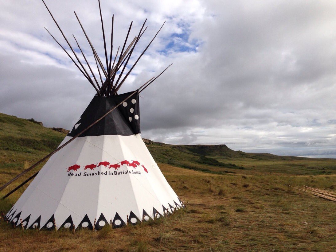
A mixture of images that represent the sites documented by the Archaeological Society of Alberta. Images were sourced from a report produced by the Archaeological Society of Alberta, Head-Smashed-In Buffalo Jump and Blackfoot Digital Library, and images produced by the Capture2Preserv Team of EaPd-7 and EaPd-8.
Digitally Capturing Sites EaPd-7 & EaPd-8
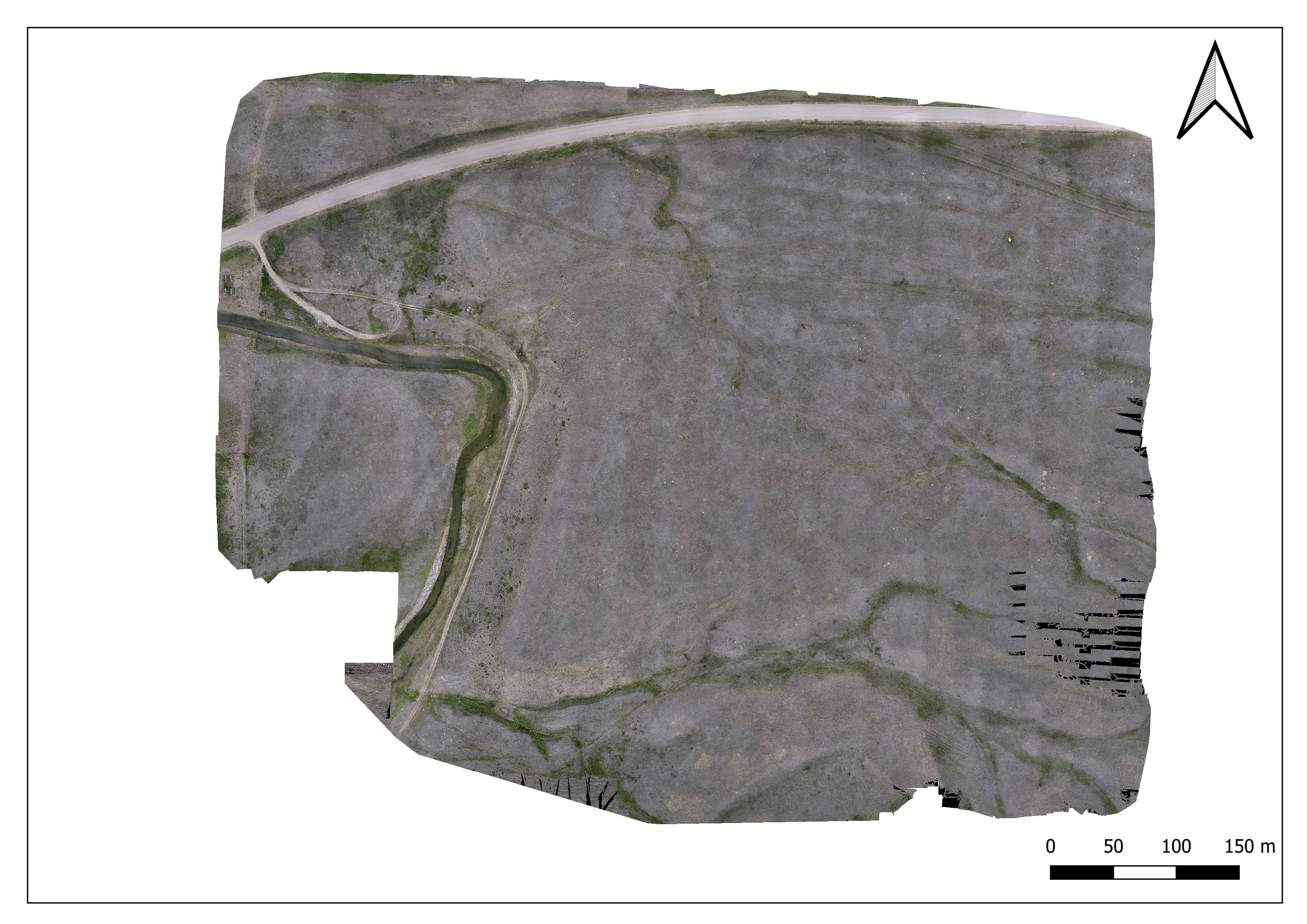
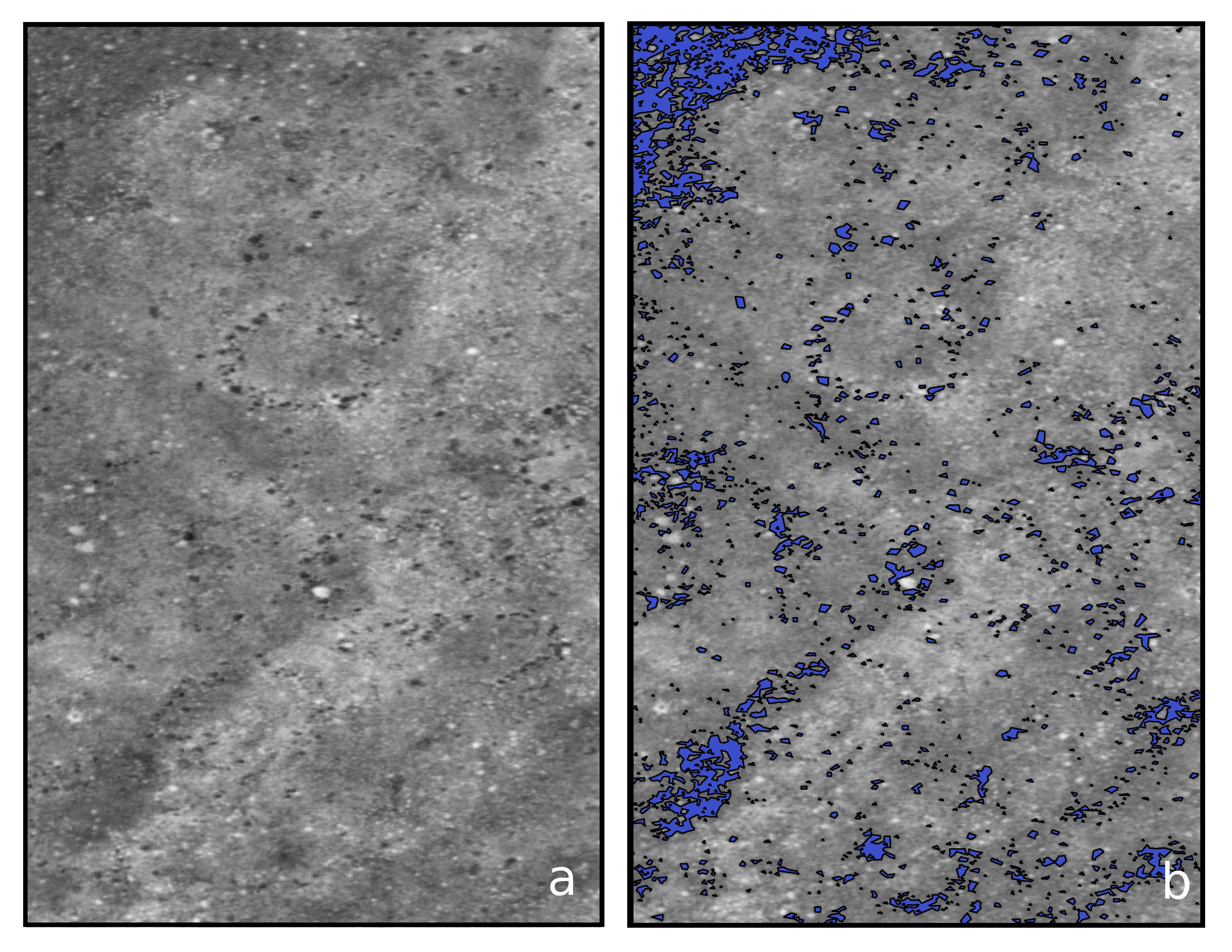
An Unmanned Aerial Viechal (UAV) was deployed at sites EaPd-7 & EaPd-8 to collect data for photogrammetric and multispectral surveys. These two techniques were used to help locate known stone circles and identify potential new stone circles.
Photogrammetric Survey
The photogrammetric survey used the DJI Phantom 4 UAV with the onboard camera, a ½.3 inch CMOS sensor, to take images and all six flights were planned and executed from the Pix4D Captureon an iPad over two days. The flights were flown in a single grid formation at 70 m above ground level with 85% overlap between images on the same grid line and 70% overlap between images on adjacent grid lines. This collected 1409 images and covered 39.5 hectares. The 1409 images recorded in the Pix4D Capture were upload to Pix4Dmapper Pro v. 4.2.26 and processed to produce an orthomosaic and Digital Surface
Model (DSM).
Multispectral Survey
For the multispectral survey, the DJI Phantom 4 was flown with the Parrot Sequoia + sensor, which has a 16-megapixel RGB camera, four 41.2-megapixel global shutter single-band cameras, and a sunshine sensor equipped with GPS. The sensors were calibrated before take-off with a radiometric calibration
target and the flight planned and executed from the Pix4D app on an iPad. The flight was flown in a single grid formation at 70 m above ground level with 186o images taken and covered 11.8 hectares. Images were processed in Pix4Dmapper Pro v. 4.2.26 with the index calculator to create the red, green,
near-infrared and red-edge reflectance value images which were then used to create the Normalized Difference Vegetation Index (NDVI) image. This raster image was then taken into ArcGIS Pro v10.6.1 where the raster was polygonised according to pixel values, the values associated with the stones in the landscape were then turned into a shapefile to be integrated with the ASA data.
Photogrammetric Data
Open Access Data
The raw data files for this project are available for download from the archive repository. This data was collected through UAV photogrammetry and has produced orthomosaic and NDVI imagery, which are in Tiff World File format. Please download the metadata template to access metadata associated with each file. All data is published under the Attribution-Non-Commercial Creatives Common License CC BY-NC 4.0 and we would ask that you acknowledge this repository in any research that results from the use of these data sets.